
Scientific dating shows that the vast smooth limestone surface below Metlina was exposed by a rockslide. That still does not make it a freely accessible, marked walking route.
A vast limestone sliding surface
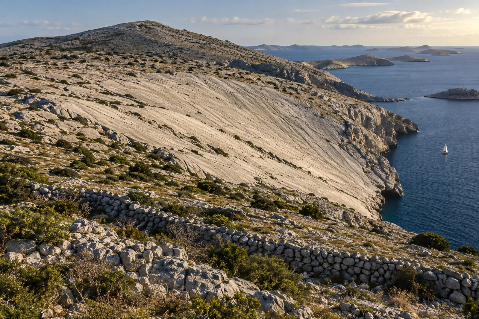
Vela ploča, also known as Magazinova škrila or simply Ploča, lies on the island of Kornat below Metlina. The national park management plan describes the bare, smooth surface as roughly 130 by 70 metres.
From a distance it looks as though it was artificially planed flat. That geometry has encouraged legends about an ancient quarry, but the geology tells a different story.
Cosmogenic chlorine-36 dates the rockslide
A research team studied the exposed surface using the cosmogenic isotope chlorine-36. The results date the rockslide that revealed the large sliding surface to about 2,400 years ago.
The method measures how long rock has been exposed to cosmic radiation at the surface. It therefore dates the exposure, not the age of the limestone itself.
No evidence of a Roman quarry
The smooth surface can be explained by the bedding of the limestone and the sliding of a large rock mass. The scientific study provides no evidence for the popular idea that Romans cut a monumental slab from this site.
That does not make the place less impressive. On the contrary, the visible structure shows how a single geological event can shape a landscape for millennia.
Why the surface looks so smooth
On Kornat, thick limestone beds lie in inclined packages. When a block detaches along such a bedding plane, it can leave an unusually even sliding surface behind.
Weathering, rain and centuries of surface processes have continued to mark the slab. Its brightness and uniformity are therefore the result of geology and time, not modern concrete work.
Below the island’s highest point
Vela ploča lies below Metlina, listed as Kornat’s highest point at 237 metres. The national park classifies the surface as a geosite — a place of particular geological importance.
That classification is not permission to use a tourist trail. Protected status, grazing land and difficult karst terrain still determine how carefully visitors must move through the area.
Three bays are named as possible starting points
A regional excursion website names Kravjačica, Strižnja and Vruje as possible starting bays. This is orientation, not a promise that every bay suits every boat, every weather situation or an arrival without further arrangements.
Anchoring, landing and visiting the national park depend on current park rules, weather, boat type and local conditions. Precise nautical directions without same-day confirmation would be irresponsible.
Access crosses private grazing land
The cited visitor information explicitly notes that the route crosses private land. Dry-stone walls must not be damaged, gates must not be left open and sheep must not be disturbed.
Anyone planning a visit should clarify access and current conditions locally and respect landowners and the park administration. A GPS point alone does not turn karst and grazing land into a public hiking trail.
No promised easy walk
The bare landscape offers little shade, the ground is uneven and sharp, and changing weather in the Kornati must be taken seriously. Sturdy footwear, water, sun protection and a realistic decision to turn back matter more than an estimated walking time found online.
Golden Beach deliberately publishes no minute-by-minute route. A dependable tour recommendation would require current information on landing, trail conditions, landowner access and park rules.
What is confirmed — and what remains open
The geological origin as a rockslide, the dating to about 2,400 years ago, the position below Metlina and its classification as a geosite in the national park management plan are confirmed.
Without a current enquiry, the best landing point, a continuously marked trail, permission for a particular crossing of private land and conditions on the day remain open. This article is therefore a geological explanation, not a promise of navigation or access.
Evidence
Sources & date
Sources support the facts. Planning notes and recommendations are Golden Beach editorial assessments.
- The Kornati rockslide: evidence for a large Holocene rock-slope failure in the Adriatic karstQuaternary International / Krklec et al. · 2018; checked 19 September 2026rockslide, geomorphological explanation and cosmogenic chlorine-36 dating to about 2,400 years ago
- Plan upravljanja Nacionalnim parkom KornatiJavna ustanova Nacionalni park Kornati · 2023; checked 19 September 2026Magazinova škrila as a geosite, its location and approximate dimensions of 130 by 70 metres
- Sustainable Tourism Development Strategy for Kornati National ParkNacionalni park Kornati · checked 19 September 2026Vela ploča as a large limestone bedding surface below the 237-metre Metlina
- Kornati excursions and group toursKornati.hr · checked 19 September 2026named starting bays and a warning about private land, dry-stone walls and grazing animals; not an official trail approval